Fire Station Plan Optimization around City of Waterloo, Ontario
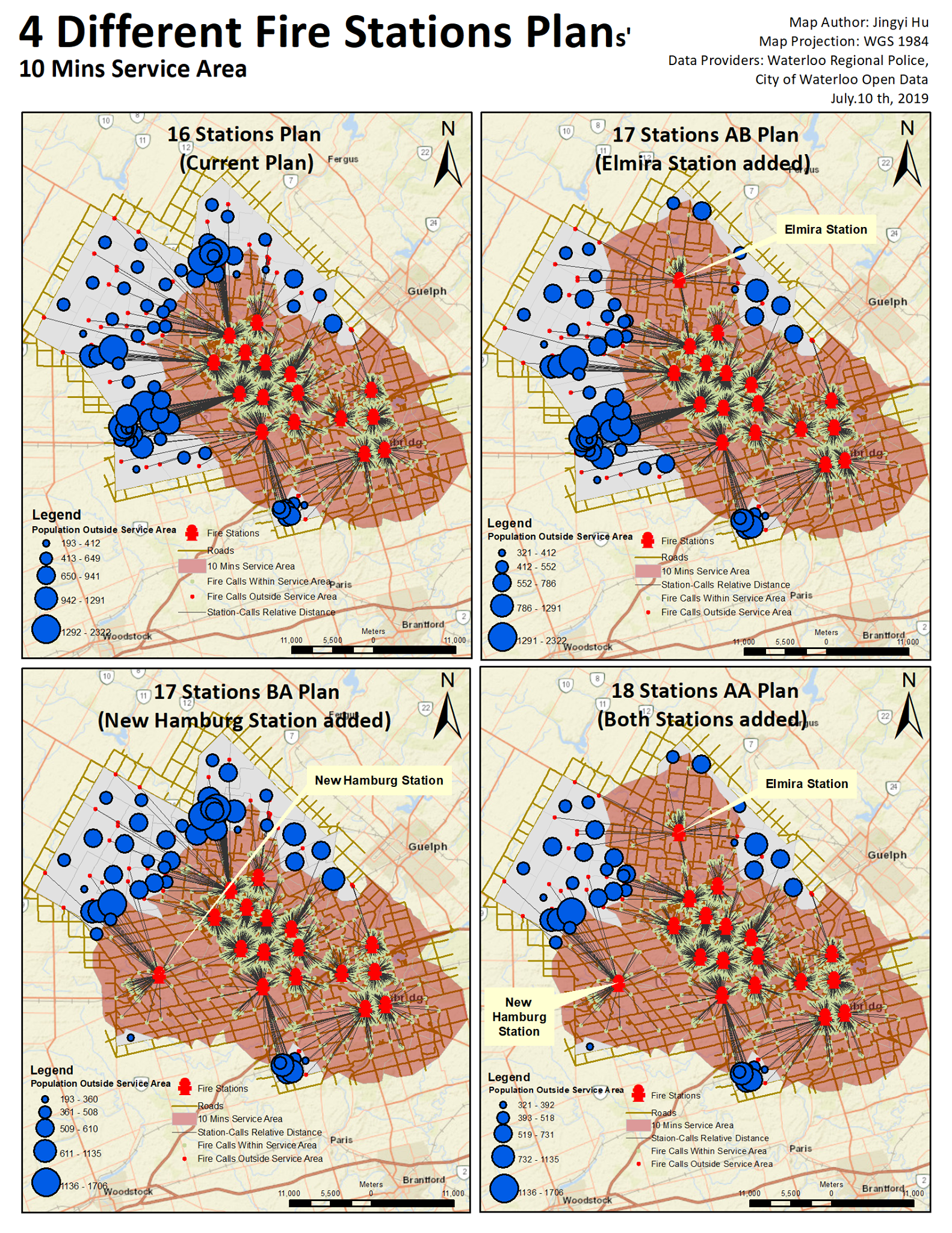
Group Maps Indicating the Detail Fire Station Plans
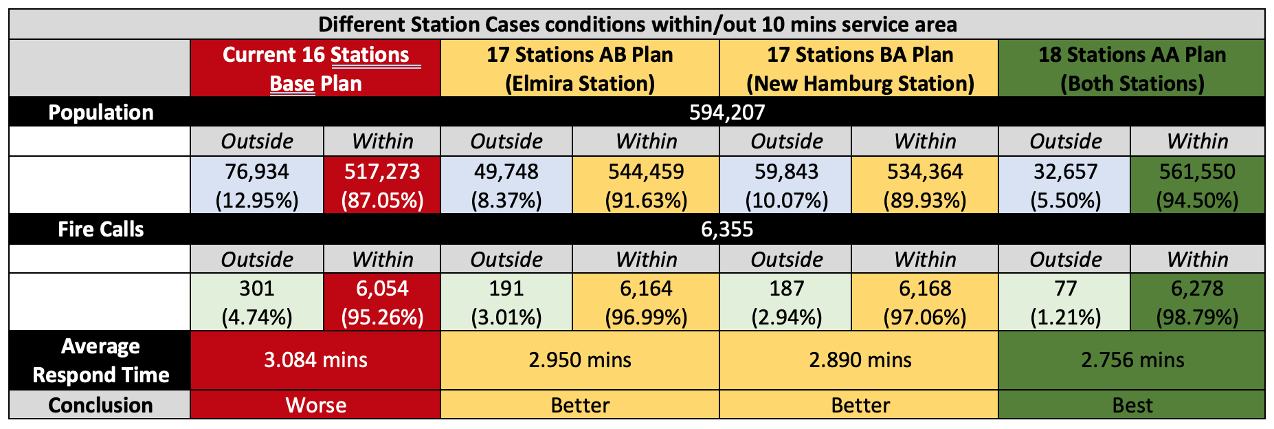
The group maps shown below indicates the current fire station plan vs. 3 proposed future fire station plans. The purpose is to analyze which plan is the more feasible and effective one to respond to fire calls from Waterloo region within 10 mins service coverage area based on current data.
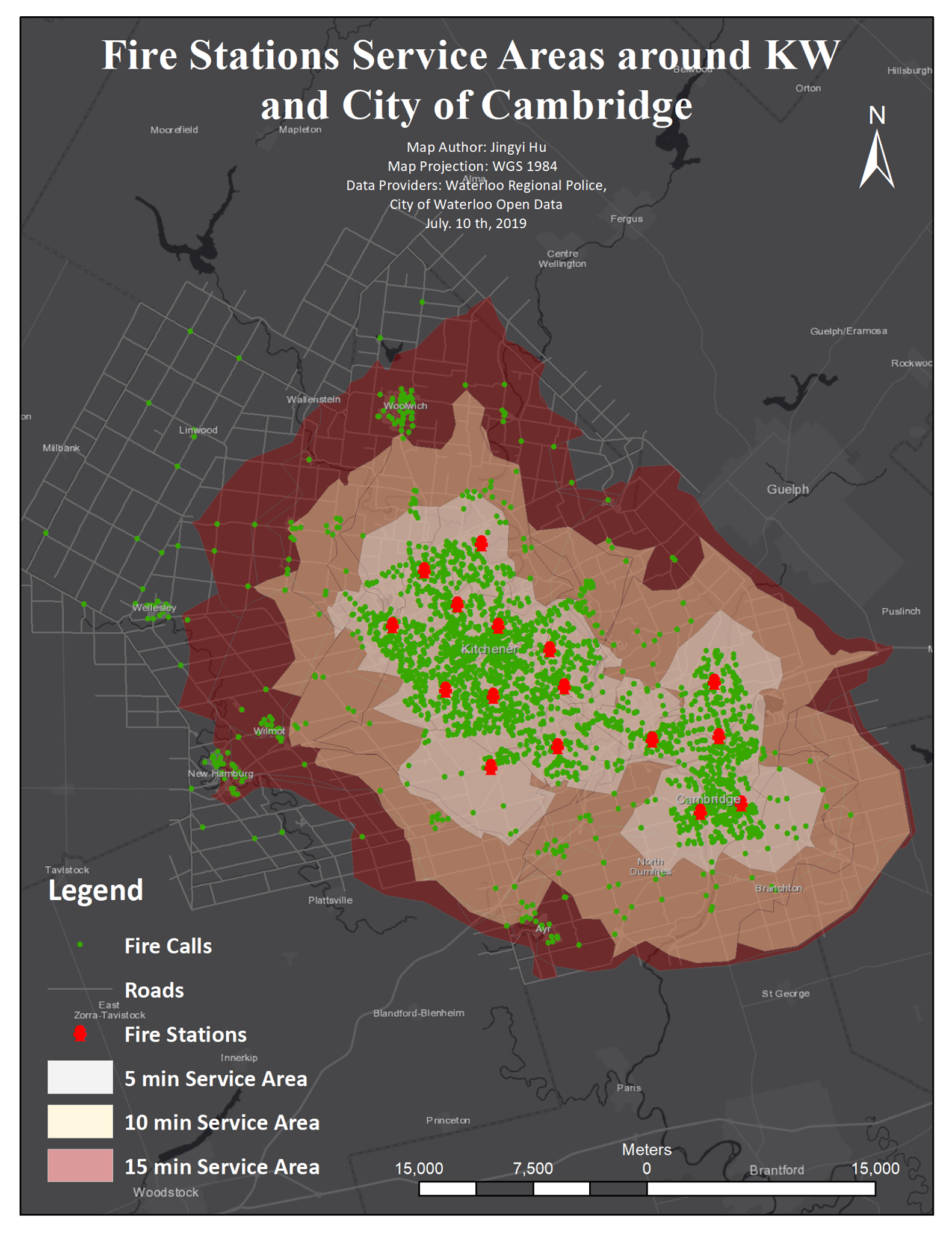
The single map attached below illustrates the different service areas of current fire stations in Waterloo within 5 mins, 10 mins, and 15 mins respectively. By applying networking-analysizing tool, the service area can be generated based on the "traveltime" of the distance from stations to fire call locations (which have been recorded as an individual field in the attribute table).
Comments Section